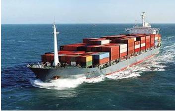
 The Long Range Identification and Tracking (LRIT) system is a designated International Maritime Organization (IMO) system designed to collect and disseminate vessel position information received from IMO member States ships that are subject to the International Convention for the Safety of Life at Sea (SOLAS).
The USCG maintains a National Data Center (NDC). The NDC monitors IMO member state ships that are 300 gross tons or greater on international voyages and either bound for a U.S.port or traveling within 1000 nm of the U.S.coast. LRIT complements existing classified and unclassified systems to improve Maritime Domain Awareness.
LRIT provides an enhanced level of Maritime Domain Awareness that is the first of its kind. LRIT is a satellite-based, real-time reporting mechanism that allows unique visibility to position reports of vessels that would otherwise be invisible and potentially a threat to the United States.
The LRIT system consists of the ship borne LRIT information transmitting equipment, Communications Service Providers (CSPs), Application Service Providers (ASPs), LRITDataCenters, including any related Vessel Monitoring System(s) (VMSs), the LRIT Data Distribution Plan (DDP) and the International LRIT Data Exchange. Certain aspects of the performance of the LRIT system are reviewed or audited by the LRIT Coordinator acting on behalf of the IMO and its Contracting Governments. For more detailed information regarding U.S. LRIT rulemaking, please refer to the LRIT Final Rule, published in the Federal Register, Department of Homeland Security, 33 CFR Part 169, on Tuesday, April 29th, 2008.
The user interface for the US NDC is located at the Navigation Center (NAVCEN) in Alexandria, Virginia. NAVCEN operates the US LRIT interface called the Business Help Desk (BHD). BHD operators can perform a multitude of operations with a web-based user interface. Within this web-based application, the BHD watchstanders can view and request vessel status, see vessel information, request vessel positions, and increase and decrease vessel reporting rates.
The US NDC stores all of the positions from any LRIT ship, foreign or domestic, that enters our coastal water polygons. This information is available in real time to the BHD watchstander after performing a basic search for a vessel using the vessel name, IMO number, or MMSI (Maritime Mobile Service Identity) number. Per the LRIT international guidelines, the default ship reporting rate is every six hours. However, functionality is built in to allow end users to request a onetime poll that gives an on-demand current position. Watchstanders can also increase the reporting rate to every 3 hours, 1 hour, 30 minutes, or 15 minutes for a specified period of time.
The United States Coast Guard has recognized Pole Star as the U.S.testing ASP that will issue Conformance Test Reports (CTR) on behalf of the United States. Previously issued CTRs issued by Pole Star or CLS America will remain valid. U.S. Vessel owner/operators are encouraged to submit a Conformance Test Request via this website to schedule a conformance test for their vessels.
To schedule an LRIT conformance test, please visit our LRIT Conformance Test Scheduling page, complete; submit the form and a member of our LRIT Business Help Desk will contact you.

An official website of the United States government

